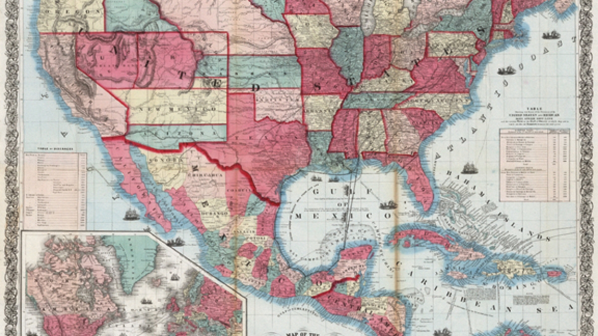
'Changing Boundaries' map exhibit at ASU depicts history

An exhibit of maps that illustrate how the present U.S.-Mexico border region has evolved over the past four centuries will be on display at ASU through Feb. 10.
The opening of the “Changing Boundaries” map exhibit coincides with an open house for the School of Transborder Studies, from 9:30 to 11:30 a.m., Oct. 12, in the Interdisciplinary B Building, Suite 164 B, 1120 S. Cady Mall, on ASU’s Tempe campus. The event is free and open to the public.
The maps on display are from the collection of Simon Burrow, who curates the exhibit. Burrow, who will be at the open house to discuss the maps as art, as well as the history behind them, has been acquiring items in his collection from map and used book dealers around the world over a span of 25 years.
Burrow was a manufacturing entrepreneur who had factories in Mexico in Mexicali and Tijuana, and in Singapore. He notes on his website that “about the time of my first Mexican factory I read a book called ‘Confessions of an Advertising Man’ by David Ogilvy. One piece of advice he gave was to make your hobby align with your career. … I started to collect maps and books showing the history of the relationship between Mexico and the United States. I framed some of the maps and hung them in my factories and offices in the U.S. and Mexico.”
The maps, which date as early as 1597, show the explorations, claims, counter claims and conquests that resulted in the current borderline. There are examples of how California was depicted as an island populated by Amazons and maps that show where ancient and mythical cities were thought to be, as well as treasure maps that would allegedly lead to Cibola – the Seven Cities of Gold.
“What I want to do with this collection is to give people an opportunity to think about borders and migration in a different way,” writes Burrow on his website at www.changingboundaries.com.
The exhibit illustrates the history of the Southwest and Northwestern Mexico region, and also adds perspective to current day discussions, said Carlos G. Vélez-Ibáñez, an ASU scholar and director of the School of Transborder Studies in ASU’s College of Liberal Arts and Sciences. “Politics, economy, geography and war are the factors most responsible for the creation of the border region but its dividing markers have also formed the complex characteristics of its evolving regional economy, politics, culture and geography,” he said.
The “Changing Boundaries” exhibit recently was at the Arizona Historical Society in Tucson. Previously, it was at California State University in Los Angeles, as well as in Tecate, Mexico.
The exhibit will be on display at ASU from 10 a.m. to 3 p.m., weekdays, when school is in session, through Feb. 10. The exhibit is co-sponsored by the School of Transborder Studies and the School of Historical, Philosophical and Religious Studies. Additional information about the exhibit, including the availability of group tours, is available online at http://sts.asu.edu or at 480-965-5091.
MEDIA CONTACTS:
Irma Arboleda, arboleda@asu.edu
480-965-0071
Carol Hughes, carol.hughes@asu.edu
480-965-6375 direct line | 480-254-3753 cell